
TFI Code + First model release
Update on the first release of the open source `trail from images` tool, and the first trail created with this tool.
5 Oct 2026
By Matthew Hilton

First trail
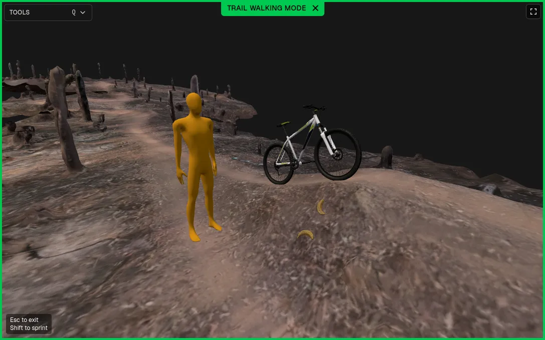
Today, the first trail is released for public viewing - find it on the trails page.
It has a number of initial features which I think could be useful, such as:
- Fly over AND walking mode, so you can get a sense of the scale. This has familiar Minecraft-style controls.
- Scale objects - to see the trail in reference so say a human, a bike, or a banana.
- Gradient - to see if its a downhill or uphill trail, or something inbetween.
The tool
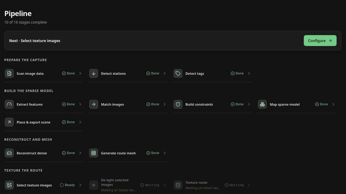
At the heart of Dirtscan is a tool, trail from images (or tfi). This is the tool I have been developing and using to take the images from a GoPro and convert them into the 3D trail models.
A custom tool is necessary because mountain bike trails are very specific types of scans, ones that most off-the-shelf tools do not handle well. Most off the shelf tools also are not open source or cost a prohibitive amount of money.
tfi is a full end to end processing tool, you literally give it images and you get trail (hence the name, trail from images). But at the heart of it is COLMAP, an open source photogrammetry program. In fact, the entire stack it uses is open source software, many parts I did not personally create.
As mentioned in our AI Statement, most of the tool is developed in conjunction with AI. Given I did not personally write it, I do not feel like I have a claim to close source the code.
In line with this, you will now start seeing our code releases on the DIY page. There you will also find the book - a short guide I wrote that explains the physical process of scanning (and importantly, how to do it safely!).
What is next
There is still a lot more to do, in particular:
- Optimisation - Currently processing time is about 30 hours per km. I want to get this down as low as possible!
- More trails - I have 2 more trails in the queue for processing.
- Multiple trails in one park, combined with actual (non-scanned) terrain - Trails are rarely isolated, and its important to know the topography of the actual park (e.g. how do you get to a trail, where are the paths, how do trails link up, etc)